The underwater waterfall, explained
Short version: the underwater waterfall is sand and silt sliding off the shallow shelf around Mauritius (about 150 m deep) into a drop-off of more than 4,000 m, just off the tip of Le Morne Brabant. No water falls. It reads as a waterfall only from a few hundred metres up, which is why the reliable ways to see it are a helicopter or a seaplane, and why the summit gives you a rough shape at best.
I spent six seasons on the helicopter apron at Sir Seewoosagur Ramgoolam airport, weighing passengers, allocating seats and telling people their slot had moved because of cloud over the gorges. I have flown the Le Morne loop more times than I can count, mostly in the jump seat. The question I got asked most was some version of: is it actually there? Here is the honest answer.
What it is
Mauritius sits on a shallow submarine shelf that goes no deeper than about 150 m. Off the south-west tip of the Le Morne peninsula, in the Black River district, that shelf ends and the seabed drops to more than 4,000 m. Currents pull sand and silt off the edge and it slides down the slope. That is the whole mechanism. No water moves vertically, the surface is flat, and there is nothing at the “bottom” but a long slope of settled sand. My grandmother in La Gaulette called it la rivière en bas la mer, the river under the sea, and she was nearer the truth than most of the internet.
Why the camera sees a waterfall
Shallow water over pale sand looks pale green; water over a 4,000 m drop looks nearly black. Where the two meet you get a hard colour edge, and the streaks of sand crossing that edge read, from a few hundred metres up, as water going over a cliff. Height and angle do the rest: from a boat the edge is a change of colour on the horizon, from the beach it is invisible, and from a mask and snorkel it is a slope. Which is why the doubt questions on is it real and how deep is it get the same short answer: yes, and it depends on how far up you are.
Where exactly
Roughly 20.47° S, 57.32° E, off the tip of the peninsula, beneath the 556 m face of Le Morne Brabant. The mountain has been a UNESCO World Heritage site since 2008 as the Le Morne Cultural Landscape, a refuge of maroons before slavery was abolished here in 1835. The lagoon and kite beach are on the north side, La Gaulette is 3 km up the coast road. From the airport at Plaine Magnien it is about 45–50 km and 60–75 minutes by taxi; from Port Louis about 50 km. Directions are at how to get to Le Morne.
The four ways to see it, and what each really shows
Helicopter. The only reliable way. Flights leave the airport helipad at Gate 3, cross the island and orbit the spot once or twice, a minute or two each time. Three flights on the tours page do this: the 40-minute airport flight, the 35-minute flight with hotel transfers, and the private 45-minute charter for up to five. Seaplane. Seaplanes do fly from the Le Morne lagoon, but the one bookable on GetYourGuide is based beside the LUX* Grand Gaube hotel on the north-east coast and flies Île aux Cerfs and the Grand Port reefs. It is a good flight and a cheaper way into the air per person; it does not see the waterfall. The summit. About four hours with an authorised guide, hands on rock for the last third, and from the top on a calm clear day you can make out the rough shape of the plume. Not the effect. Boat, beach, snorkel, dive. Nothing. The catamaran day is a fine day; it is not this.
The helicopter loop, minute by minute
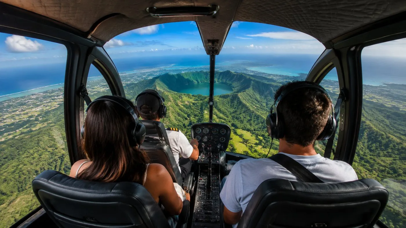
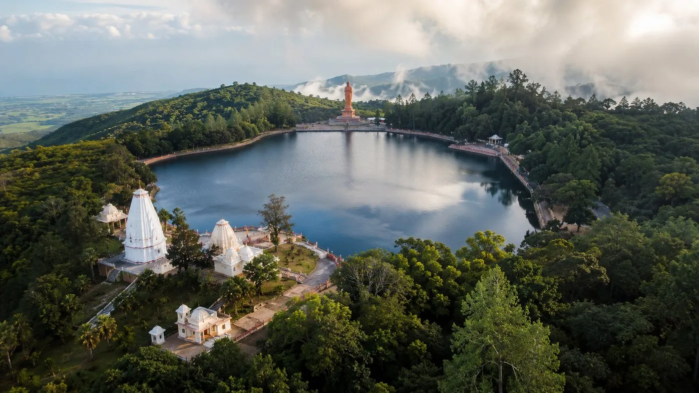
Arrive at Gate 3 thirty minutes before your slot with your passport; the helipad is airside. You are weighed, seats are allocated for balance, and a party can be split across two aircraft because they carry four or six. Headsets on, and the first leg climbs inland to Grand Bassin, the crater lake at about 550 m with the 33 m Shiva statue at its gate, and Kanaka crater beside it. Then across the Black River Gorges, 6,574 ha of native forest, and out to Flic en Flac and down the west coast. Roughly halfway round the pilot calls Le Morne, banks over the tip, and you get the pass. Then Chamarel, the coloured dunes and the 100 m waterfall, the south coast, and home. Forty minutes, of which the sandfall is a few. The transfer flight comes at the same spot down the west coast from Tamarin instead. Full detail in the helicopter tour review.
Weather and light
You want the sun high, roughly 10:00 to 14:00, a calm sea and little swell. After heavy rain or a big south-westerly swell the plume goes muddy and the contrast dies, and no pilot can fix that. Cloud builds over the gorges in the afternoon, so mornings fly better. May to November is the dry season with the calm lee coast; January to March is cyclone season and cancels most flights. If it is cloudy over the gorges, move your date. Every flight here cancels free up to 24 hours before, and the operator reschedules or refunds when the weather does the cancelling. More at best time to see it.
Who should skip the flight
Anyone pregnant, anyone with a bad back, and anyone who gets motion sick in a car; the operator will refuse the first two and you will regret the third. Anyone whose budget the flight would break: the hike is a fraction of the price and a better morning than most people expect, and if you must fly, the seaplane is cheaper per person, just be clear it is a north-east flight. Families with children under seven, on the other hand, are better in the helicopter than the seaplane, which will not take them. Everyone else: pick a morning slot in the dry season, ask for a window, and read is it worth it if you are still on the fence.
Ready to book?
The airport helicopter loop is the flight built around the illusion: Grand Bassin, the gorges, the west coast, one or two orbits off Le Morne, then Chamarel. Live availability and the current price are below; the flight with hotel transfers and the private charter are the alternatives.
Frequently asked questions
Is the underwater waterfall a real waterfall?
No. It is an optical illusion made by sand and silt moving off the edge of the island's shelf into deep water. Nothing falls. The full explanation is on is it real.
What is the only way to see it properly?
From the air. Helicopter flights from the airport helipad and seaplanes flying the Le Morne lagoon are the reliable options; boats and the beach show nothing. See how to see it.
When is the best time to fly?
May to November for calm seas and clear skies, mid-morning when the sun is high and cloud has not yet built over the gorges. Details on best time.